Why we love old movie locations — especially the Iverson Movie Ranch
For an introduction to this blog and to the growing interest in historic filming locations such as the Iverson Movie Ranch — the most widely filmed outdoor location in movie and TV history — please read the site's introductory post, found here.
• Your feedback is appreciated — please leave comments on any of the posts. • To find specific rock features or look up movie titles, TV shows, actors and production people, see the "LABELS" section — the long alphabetical listing on the right side of the page, below. • To join the MAILING LIST, send me an email at iversonfilmranch@aol.com and let me know you'd like to sign up. • I've also begun a YouTube channel for Iverson Movie Ranch clips and other movie location videos, which you can get to by clicking here. • Readers can email the webmaster at iversonfilmranch@aol.com.
One of the many historic movie roads on the former Lower Iverson Ranch appears in this shot from the old Allan "Rocky" Lane serial "Daredevils of the West."
A stagecoach that has lost its team of horses careens out of control toward a cliff — we know it's careening toward a cliff because that's what stagecoaches always did after losing their horses in old movies.
Location of the shot as it appears today (Bing bird's-eye view)
In the real world, the old road does in fact lead to the top of a cliff — Nyoka Cliff. This bird's-eye view of the site shows the approximate position of the stagecoach as it speeds west toward the cliff.
The Iverson family referred to the road as "Cliff Road." Nyoka Cliff and Cliff Road today are situated just east of Redmesa Road in Chatsworth, Calif., a short distance north of Santa Susana Pass Road.
The "road" as it appeared on a visit to the site in 2016
Cliff Road is completely overgrown now — in fact, it would be a stretch to call it a road, as any part of it that may have once been stagecoach-worthy has been lost to time, history and the forces of entropy.
The concept of entropy comes up a lot in movie location research — especially in places like the Iverson Ranch, where much of the site's past glory has been reclaimed by nature.
"Life After People": Hollywood's Cineramadome gets swallowed up
One of the best treatments of entropy is found in the History Channel TV series "Life After People," which depicts what might become of the artifacts of civilization should the human race be wiped out.
Cliff Road in "The Life and Legend of Wyatt Earp" (1959)
Back in the filming days, before entropy set in, Cliff Road was the Autobahn of movie roads: smooth, wide and well-maintained, as seen in this shot from the "Wyatt Earp" episode "Wells Fargo Calling Marshal Earp."
The episode premiered on Dec. 29, 1959. A number of the rocks seen in the "Wyatt Earp" shot can be matched up with more recent photos.
Here are the same rocks noted in the "Wyatt Earp" screen shot, as they appear in the 2016 photo of the road area. To see the background rocks in detail you can click on the photo to enlarge it.
1959 aerial, showing a well-defined Cliff Road
The wide, well-defined Cliff Road really pops out in a 1959 aerial photo. Like most of the roads on the Iverson Ranch, the Cliff Road appeared in its share of movies and TV shows.
"The Fugitive" TV series (January 1965 — filmed in 1964)
Cliff Road had ample room for a sadistic sheriff to kick up dust in his 1964 Ford police wagon as he tormented a fleeing prisoner in "The Fugitive." This shot comes from the episode "The Nicest Fella You'd Ever Want to Meet."
Pat Hingle and worried prisoner Tom Skerritt — "The Nicest Fella You'd Ever Want to Meet"
The sadistic sheriff, Joe Bob Sims, was played with panache by Pat Hingle, and the prisoner he chased in his Ford wagon was Neely Hollister, played by Tom Skerritt. Iverson's Rock Island can be seen in the rear window.
Sheriff Joe Bob's specially outfitted Ford on Iverson's Steep Canyon Road
Joe Bob's wagon had a set of bull horns installed on the hood to maximize the intimidation factor and make a "point" about who had the upper hand — kind of silly, all things considered.
Iverson's "Steep Canyon" in modern times (2017 Bing bird's-eye view)
The station wagon sequence is stitched together using a couple of different roads on the Lower Iverson: the Cliff Road up above, and a section of Steep Canyon Road below, along the base of Nyoka Cliff.
Joe Iverson builds Steep Canyon Road (ca. early 1930s)
Steep Canyon Road was put in by Joe Iverson back in the early 1930s as the
Iverson Movie Ranch adapted to the surge in business that came along
with the movie industry's transition to sound films.
Misinformation on the LAMountains.com website
Film historians often call Steep Canyon Road "the Stagecoach
Road" — a label that has had unintended consequences by contributing to the false belief that the road was part of an actual stagecoach route into Los Angeles. In reality the road was never anything more than a movie and TV road.
Nyoka Cliff, Steep Canyon Road and the Iverson Gorge in 2018
This photo from a recent visit to the Iverson Ranch, taken looking east from across the Gorge in the Garden of the Gods, shows the area where both Steep Canyon Road and the Cliff Road can still be found.
Some readers will recognize Stoney Point toward the right. The Chatsworth landmark appeared frequently in the background in productions filmed on the Iverson Ranch, but was rarely used as a filming location in its own right.
Prominently featured in the photo are the heavily filmed Nyoka Cliff and Lower Nyoka Cliff.
Running generally north and south along the Iverson Gorge, or Steep Canyon, is the Steep Canyon Road, whose route includes a key section along the base of the scenic cliffs.
This section of the road is reinforced by stone buttressing that was put in place when the road was built. For the most part this buttressing can still be found at the site today.
Here's a closer look at some of the buttressing as it appeared on that same recent visit.
The route of Steep Canyon Road hugs the base of the Lower Nyoka Cliff through this area.
The buttressing in the shot appears in two main segments, each of which remains largely intact.
Promo still for the 1953 Gene Autry movie "Pack Train" (photo from the Jerry England collection)
A promotional photo from 1953 gives an idea of what the road and the buttressing looked like back when the ranch was an active filming location.
Northbound on Steep Canyon Road: "The Millerson Case" (1947)
The well-maintained road was filmed regularly from the '30s into the '60s, and could easily be navigated by auto.
An impassable Steep Canyon Road in modern times
Similar to Cliff Road up above, Steep Canyon Road has been largely reclaimed by nature and today is virtually impassable in places, even on foot.
High above Steep Canyon Road, Cliff Road runs east from park property above Nyoka Cliff into private property that was once the southeastern corner of the Iverson Ranch.
Cliff Road's "Gate to Nowhere"
There's a no-man's land along Cliff Road where the lines blur between park property and private property. This area is marked by an unusual modern "improvement" I call the "Gate to Nowhere."
As the name suggests, the gate does not appear to lead anywhere. It's just sitting there all by itself — not even attached to a fence. But the "Private Property" sign affixed to the gate makes its intentions clear.
Just behind the Gate to Nowhere is a movie rock. For our purposes we can call it "Gate to Nowhere Rock."
"Daredevils of the West": Gate to Nowhere Rock
Remember the shot at the top of this post from the serial "Daredevils of the West"? That's Gate to Nowhere Rock at the right of the frame — with the runaway stage headed straight for the future site of the Gate to Nowhere.
"The Roy Rogers Show" (1951)
Here's a similar shot from an early episode of "The Roy Rogers Show," with Gate to Nowhere Rock again seen at the right. The episode is "Doc Stevens' Traveling Store" — and that's the store traveling along Cliff Road.
Google aerial showing a portion of the Lower Iverson
This recent aerial photo from Google shows most of the Lower Iverson, including the entire area that has been preserved as public parkland. I've pinpointed where the Gate to Nowhere and its nearby rock can be found.
Google map of the Lower Iverson: The area in green has been preserved as public land
Besides spanning a road that goes nowhere and is both unusable and inaccessible, the gate and its "Private Property" sign are totally in the wrong place. The gate is positioned well within park boundaries, on public land.
Film industry pioneer William N. Selig with cowboy actors and Blackfoot Indians (1912)
Back before the Hollywood film industry existed, William Nicholas Selig — known today as "the man who invented Hollywood" — settled on the Edendale section of L.A. to open Southern California's first film studio.
Rented bungalow at 1845 Allesandro St. in Edendale — site of Selig's first West Coast studio
It was 1909, and this rented bungalow on Allesandro Street — today's Glendale Boulevard — is said to be where it all started. Soon as many as 30 studios — including Pathe, William Fox, Bison Film Co., Keystone and other early operations — would be in business along a four-block stretch of Allesandro.
Later version of Selig's Edendale studio, with its fancy new gate
Allesandro between Effie and Duane, in what is now the Silver Lake-Echo Park neighborhood, was the forerunner of Hollywood — the West Coast base for a film industry that was still finding its footing in the early teens.
Google street view of the Jack in the Box on Glendale Boulevard in Silver Lake
Almost nothing survives today of the original Edendale studios, but there are exceptions. Notice the large building designated here with a blue arrow, tucked in behind the Jack in the Box on Glendale Boulevard.
The building was once the centerpiece of Mack Sennett's Keystone Pictures studio. Seen here in an early photo with the Mack Sennett sign on top, the building is said to be history's first fully enclosed film stage and studio.
Located today at 1712 Glendale Blvd., the former Mack Sennett building is now part of the Public Storage facility.
"The Outbreak" (Selig Polyscope, released on March 2, 1911)
The first Hollywood studio, the Nestor Motion Picture Co., would open in late 1911. But almost a year before that milestone, William Selig's Edendale operation, Selig Polyscope Co., made a short Western called "The Outbreak."
Still photo from filming of "The Outbreak"
Almost
nothing is known about "The Outbreak" — not even who starred in it or
who directed it. The movie itself is lost, but one photo that
survives from the film's production contains more than its share of history.
While the cast members are unknown, it's possible to determine from the plot description that the two terrified women seen huddled together here are being held captive.
The terrain surrounding the group appears hand-picked to suggest the stark, perilous nature of the American West. Each corner of the frame, in its own way, says, "Don't mess with me."
It's no accident, then, that decades later, this tortured terrain would in fact become a widely seen symbol of the West, appearing in hundreds of movies and TV shows. The presence of a familiar movie feature known to historians as "Fort Apache Rock" pinpoints this unforgiving land as the future site of Corriganville.
"Santa Fe Stampede" (Republic, 1938): An early Corriganville appearance by Fort Apache Rock
The smooth-faced rock outcropping casts a striking and immediately identifiable profile in its screen appearances — which until now were known to date back only to the late 1930s.
"Wyoming Outlaw" (Republic, 1939)
Almost everything we previously knew about Fort Apache Rock came from productions spanning less than 30 years, from the earliest filming at Corriganville in late 1937 until the arrival of the 118 Freeway in the 1960s.
The background hills as they appear today, with Fort Apache Rock missing
With progress comes sacrifice, and sadly, Fort Apache Rock became a casualty of the freeway that today is a major route from Simi
Valley and Ventura County into the San Fernando Valley and L.A.
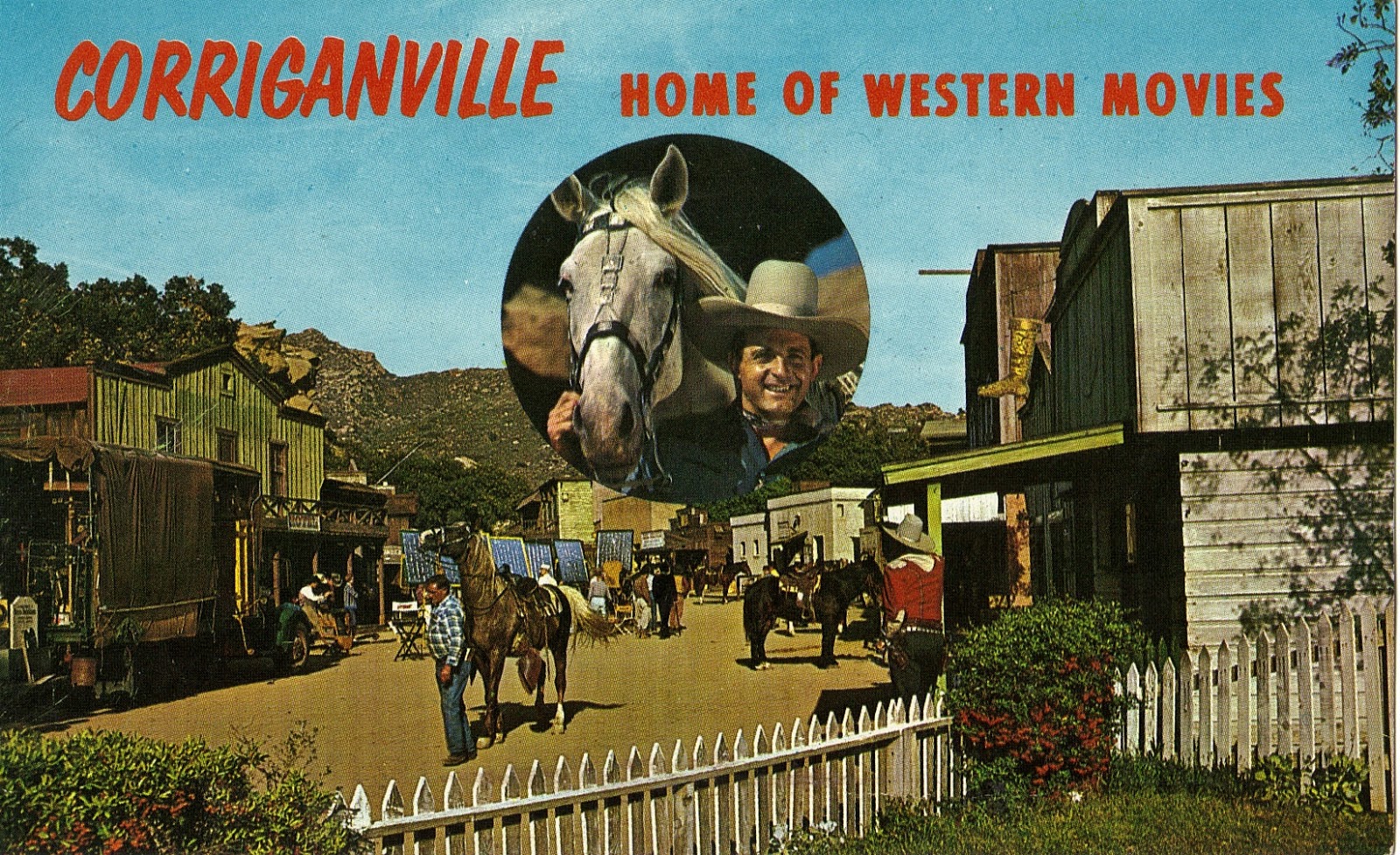
The Corriganville story is traditionally thought to go back only to 1937, when B-Western cowboy Ray "Crash" Corrigan took ownership of a rocky swath of foothill property in the southeastern corner of Simi Valley.
"Tarzan the Ape Man" (1932): One of Ray Corrigan's first gorilla suits
Corrigan had just found his way into the movie business five years earlier, starting out as a stuntman and an uncredited guy in a gorilla suit — including an appearance in Johnny Weissmuller's first Tarzan movie, filmed in part on the Iverson Ranch.
Ray "Crash" Corrigan, movie cowboy (Lower Iverson Ranch)
"Crash" was already an accomplished cowboy actor by 1937, but he dreamed of something more. Germinating inside of Ray Corrigan were the seeds of a vision that would blossom into Corriganville — a thriving movie ranch, sure, but also a place where children's Wild West fantasies could take flight.
"Overland Stage Raiders" (Republic, 1938) — L-R: Ray Corrigan, John Wayne and Max Terhune
Corrigan had become a fixture in Republic's Western trio series "The Three Mesquiteers" — a steady paycheck, but one that required him to play second fiddle, first to Robert Livingston and later to John Wayne.
Readers who keep up with the Iverson Ranch might recognize Eagle Beak Rock in this shot. The big sandstone promontory, which turns up all the time in chase scenes, remains in place today on the former Upper Iverson.
"Undersea Kingdom" (Republic serial, 1936)
Ray Corrigan would have been feeling pretty flush in 1937 — at least by B-movie cowboy standards. He had recently been promoted to leading man status, including a juicy starring role in the serial "Undersea Kingdom."
"Pals of the Saddle" (Three Mesquiteers, 1938): Ray Corrigan, center
With the ink barely dry on the deed to his new Simi Valley property, Corrigan opened the place to film shoots — and business was good. By mid-1938 a full slate of films was in production at Corriganville — including Ray Corrigan's own "Three Mesquiteers" movies, which had previously shot largely on the Iverson Ranch.
Here again, Fort Apache Rock looms in the background — and looming in the background was its specialty.
Corriganville postcard (1950s): Ray Corrigan and his Western movie set, "Silvertown"
As the movies came to Corriganville, sets were built — a Western town, a lake, a Corsican village and various cabins, caves, bridges and barns. Ray Corrigan kept the pieces intact, groomed it all into something resembling a frontier theme park, and in 1949 he began opening the gates to the public on weekends.
Corrigan's own house was a part of the set, positioned at the end of the main street through Silvertown. The postcard shows the view looking northeast along the main street from Corrigan's yard.
"The Fighting Lawman" (Allied Artists, 1953): Southwest end of Silvertown
The same picket fence noted on the postcard, outside Ray Corrigan's home, can be seen in movie shots of Silvertown, along with Corrigan's house, all but hidden at the southwest end of the street.
Bird's-eye view of Silvertown in the mid-1950s
By the mid-1950s, Corriganville's Silvertown had grown into an elaborate Western set, bustling with film and TV shoots during the week and hosting a stream of tourists on the weekends that was said to rival attendance at Disneyland and Knott's Berry Farm, Southern California's top theme parks of the era.
Once again, Ray's house can be spotted at the southwest end of town.
Fort Apache, built in 1947 for John Ford's "Fort Apache," released in March 1948
When John Ford needed a fort for his Western "Fort Apache," he built one at Corriganville. I can imagine Ray telling him, "Don't worry about the mess, John — I'll clean it up" ... and then re-using the fort for the next 20 years.
It may go without saying, but it was Fort Apache that gave rise to the name "Fort Apache Rock" for that smooth cliff face, which hovers — OK, looms — behind the fort in shots taken with the camera facing north.
Henry Fonda and John Wayne at Fort Apache
Ford's big-budget "Fort Apache," starring John Wayne and Henry Fonda, became known as the first part of the director's "Cavalry Trilogy," followed by "She Wore a Yellow Ribbon" in 1949 and "Rio Grande" in 1950.
"Fort Apache": Shirley Temple, John Agar and John Wayne on the Corriganville fort set
The movie also starred a 19-year-old Shirley Temple, seen here outside one of the main buildings on the original Fort Apache set. Also pictured are John Wayne and John Agar, Temple's real-life husband at the time.
Shirley Temple and John Agar: Happier times?
Temple and Agar married when Temple was just 17, and wound up in a bitter divorce five years later. Some critics have noted that the couple did not appear to have much chemistry as a romantic pairing in "Fort Apache."
Shirley Temple at Fort Apache
Temple's career in movies wouldn't last much beyond "Fort Apache." Her body may have grown up, but she had a hard time convincing audiences that she wasn't still the 6-year-old who sang "On The Good Ship Lollipop."
Shirley Temple, age 6, delivers her signature song in "Bright Eyes" (1934)
Come to think of it, would this even be considered appropriate in the Hollywood of the #MeToo era?
"The Adventures of Rin Tin Tin" (1954-1959): Steady work for Fort Apache
The Fort Apache set would undergo a series of adaptations over the years, notably the addition of a high wooden wall that made it look more like, well, a fort.
Two youngsters endure a photo op outside the fort — complete with a dumb sign for the tourists
Not only did the high wall give Fort Apache more of that frontier fort je ne sais quoi it needed for the movies, it also proved useful in the fort's weekend job: convincing children that they were at a real deal Wild West fort.
Kids playing at Fort Apache, ca. early 1960s
And it worked: As the souvenir booklet promised, everyone really did have fun at Corriganville.
A
bird's-eye view of the fort taken in the 1950s, with the camera facing
west, shows more of the wall along with some deteriorating movie buildings — and appears to show the fort being used for overflow tourist parking.
For
a look at Fort Apache from a tourist's-eye view, here's a little home movie footage of a 1956 Corriganville visit. The
first segment features Fort Apache. (You can also stay tuned for gunfights, fistfights, a stage holdup, etc.)
"Fort Vengeance" (1953): Fort Apache in glorious Cinecolor
Movie and TV work found Fort Apache playing a series of "other forts": Fort Bravo, Fort Vengeance and so on. On the "Rin Tin Tin" TV show, in the true spirit of "if it ain't broke, don't fix it," it was Fort Apache.
Fort Apache Rock rears its stony head, yet again
There's our old friend again — Fort Apache Rock ... and it's telling us it's time to get back on track — back to 1911, and back to our story about what must have been the Great Rock's first foray into the movies.
"The Outbreak" (1911): What else is up in the old neighborhood?
With Fort Apache Rock gone now, I wanted to match up anything I could find of the other rock features seen in the "Outbreak" shot. To begin that process, notice the cluster of rocks highlighted here.
This is the same cluster in modern times. You can't miss it if you're out exploring Corriganville, wondering where the heck Fort Apache Rock went. Back in the day this group blended in with Fort Apache Rock and would have been easy to miss, but these days it pretty much has the spotlight all to itself.
By the way, is this place beautiful or what?
Here's another view. I think of the formation as a "Mini-Me" version of Fort
Apache Rock that got left behind when the freeway came through. Depending on the angle, it marks the spot where Fort Apache Rock
should be.
"Fort Apache": The understudy takes a bow
The "Mini-Me" rock did have its moments back in the filming era, including this solo
appearance in "Fort Apache." The shot was taken from the fort, but at a low enough angle
that Fort Apache Rock disappeared over the horizon.
While we're in the area, I also want to point out the 118 Freeway, trying in vain to blend into the background and acting like it had nothing to do with the disappearance of a major movie rock.
The "Mini-Me" rock: All huff and no puff
For all its landmark aura, I didn't find the "Mini-Me" rock to be of much use in trying to locate other rocks from "The Outbreak." When it came time to get down to some serious triangulating, "Mini-Me" just didn't have it.
"The Outbreak": Some background rocks that could come in handy
On the other hand, the rocks noted here turned out to be terrific triangulation partners. Once I locked in on this crowd, I had a hunch that if I could find them in the current century, I'd be in business.
Here's a shot zeroing in on those same rocks, again from the 1911 photo.
And here they are more than 107 years later, on an expedition to the site just a couple of weeks ago.
I was able to pick them out among the boulders in those background hills to the north.
Some of the key marker rocks are identified in the 2018 photo
One nice thing about these rocks is that the sharp "beak" on Rock A makes it relatively easy to tell whether we're seeing it from the angle we need to see it from — the same angle seen in "The Outbreak."
The same rocks can be identified in the 1911 photo
And we are — or at least pretty close. Everything matches up nicely. If only it were always this easy.
You may already have a sense of where this is heading, but the No. 1 objective was always to try to find the main clump of foreground rocks — the ones with all the people gathered on them. This turned out to be not so easy.
The same rocks seen in "The Outbreak," as they appear in 2018
It took three separate expeditions to Corriganville, but ultimately I was able to find them. The rocks are in a remote part of the former movie ranch that I would guess has rarely if ever been filmed since that one time in 1911.
Here's a wider view of the rocks showing more of the background the filmmakers would have seen when they shot the movie in 1911 — although clearly it's not the same without Fort Apache Rock in the picture.
I believe the camera would have been positioned on top of the same rock where I stood when I took these pictures. Due to the difficulty in accessing the area, I suspect they didn't bring along any camera scaffolding.
Corriganville in recent times (Bing aerial)
This aerial shot depicts the main portion of the former Corriganville Movie Ranch, which today is contained in Corriganville Park. It's open to the public, and you can enter from the southwest off Smith Road.
Zooming in on the hill that sits right in the middle of Corriganville, this is where "The Outbreak" was filmed. It's a fairly rugged climb, and I can't recommend the route I took, but if you're determined enough, you can get there.
Two rocks marked with the white "X" (Google 3D photo)
One way you'll know you've found the rock is that it happens to have a big white "X" on it — presumably these are surveyor's marks used in aerial mapping. A second "X" rock can also be found nearby but the "Outbreak" rock is the farther south of the two.
"Rattles," defender of the "Outbreak" location
A word of warning if you're considering heading up to the "Outbreak" filming site: Along with the usual poison oak and other issues, the place is riddled with large rattlesnakes, as noted in the comments below.
The discovery of the "Outbreak" shooting location leaves a lot of questions unanswered. Here are a few of my "fantasy" questions:
• We know they got at least one great shot during their visit to "pre-Corriganville" Corriganville for "The Outbreak," but which other features did they film? Sadly, since the movie is lost, we'll probably never know.
• Why did they go to the trouble to get to such an inaccessible spot to shoot these particular rocks? The area had plenty of other rocks to choose from, and almost any of them would have been easier to get to.
• Which brings up a related question: How on Earth did they get all the way up there with a full cast and crew, along with a lot of heavy, delicate silent movie gear, with no roads and presumably not even so much as a trail?
• Now that we know there was filming at Corriganville more than a quarter-century before it became Corriganville, what else might have been filmed there before 1937?
I want to give a big shout-out to historian and author Carla Bollinger, who pointed me to the release flier for "The Outbreak." That was one heck of a find.
Off
the Beaten Path is a series of posts that stray from the usual subject
matter of this blog, which is the Iverson Movie
Ranch. In addition to Corriganville, past subjects have included Franklin Canyon, Bell Ranch,
Pioneertown, Oak Park, various corners of Chatsworth and
other old filming locations. You can go directly to the Off the Beaten
Path posts by looking
up the term "Off the Beaten Path" in the long index of labels at the
right of the page, or by clicking here.