Why we love old movie locations — especially the Iverson Movie Ranch

For an introduction to this blog and to the growing interest in historic filming locations such as the Iverson Movie Ranch — the most widely filmed outdoor location in movie and TV history — please read the site's introductory post, found here.
• Your feedback is appreciated — please leave comments on any of the posts.
• To find specific rock features or look up movie titles, TV shows, actors and production people, see the "LABELS" section — the long alphabetical listing on the right side of the page, below.
• To join the MAILING LIST, send me an email at iversonfilmranch@aol.com and let me know you'd like to sign up.
• I've also begun a YouTube channel for Iverson Movie Ranch clips and other movie location videos, which you can get to by clicking here.
• Readers can email the webmaster at iversonfilmranch@aol.com
.

Showing posts with label buttressing. Show all posts

Sunday, March 25, 2018

Cliff Road, Steep Canyon Road and the "Gate to Nowhere" on the old Iverson Movie Ranch — and something for fans of "The Fugitive"

"Daredevils of the West" (Republic serial, 1943)

One of the many historic movie roads on the former Lower Iverson Ranch appears in this shot from the old Allan "Rocky" Lane serial "Daredevils of the West."

A stagecoach that has lost its team of horses careens out of control toward a cliff — we know it's careening toward a cliff because that's what stagecoaches always did after losing their horses in old movies.

Location of the shot as it appears today (Bing bird's-eye view)

In the real world, the old road does in fact lead to the top of a cliff — Nyoka Cliff. This bird's-eye view of the site shows the approximate position of the stagecoach as it speeds west toward the cliff.

The Iverson family referred to the road as "Cliff Road." Nyoka Cliff and Cliff Road today are situated just east of Redmesa Road in Chatsworth, Calif., a short distance north of Santa Susana Pass Road.

The "road" as it appeared on a visit to the site in 2016

Cliff Road is completely overgrown now — in fact, it would be a stretch to call it a road, as any part of it that may have once been stagecoach-worthy has been lost to time, history and the forces of entropy.

The concept of entropy comes up a lot in movie location research — especially in places like the Iverson Ranch, where much of the site's past glory has been reclaimed by nature.

"Life After People": Hollywood's Cineramadome gets swallowed up

One of the best treatments of entropy is found in the History Channel TV series "Life After People," which depicts what might become of the artifacts of civilization should the human race be wiped out.

Cliff Road in "The Life and Legend of Wyatt Earp" (1959) 

Back in the filming days, before entropy set in, Cliff Road was the Autobahn of movie roads: smooth, wide and well-maintained, as seen in this shot from the "Wyatt Earp" episode "Wells Fargo Calling Marshal Earp."

The episode premiered on Dec. 29, 1959. A number of the rocks seen in the "Wyatt Earp" shot can be matched up with more recent photos.

Here are the same rocks noted in the "Wyatt Earp" screen shot, as they appear in the 2016 photo of the road area. To see the background rocks in detail you can click on the photo to enlarge it.

1959 aerial, showing a well-defined Cliff Road

The wide, well-defined Cliff Road really pops out in a 1959 aerial photo. Like most of the roads on the Iverson Ranch, the Cliff Road appeared in its share of movies and TV shows.

"The Fugitive" TV series (January 1965 — filmed in 1964)

Cliff Road had ample room for a sadistic sheriff to kick up dust in his 1964 Ford police wagon as he tormented a fleeing prisoner in "The Fugitive." This shot comes from the episode "The Nicest Fella You'd Ever Want to Meet."

Pat Hingle and worried prisoner Tom Skerritt — "The Nicest Fella You'd Ever Want to Meet"

The sadistic sheriff, Joe Bob Sims, was played with panache by Pat Hingle, and the prisoner he chased in his Ford wagon was Neely Hollister, played by Tom Skerritt. Iverson's Rock Island can be seen in the rear window. 

Sheriff Joe Bob's specially outfitted Ford on Iverson's Steep Canyon Road

Joe Bob's wagon had a set of bull horns installed on the hood to maximize the intimidation factor and make a "point" about who had the upper hand — kind of silly, all things considered.

Iverson's "Steep Canyon" in modern times (2017 Bing bird's-eye view)

The station wagon sequence is stitched together using a couple of different roads on the Lower Iverson: the Cliff Road up above, and a section of Steep Canyon Road below, along the base of Nyoka Cliff.

Joe Iverson builds Steep Canyon Road (ca. early 1930s)

Steep Canyon Road was put in by Joe Iverson back in the early 1930s as the Iverson Movie Ranch adapted to the surge in business that came along with the movie industry's transition to sound films.


Misinformation on the LAMountains.com website

Film historians often call Steep Canyon Road "the Stagecoach Road" — a label that has had unintended consequences by contributing to the false belief that the road was part of an actual stagecoach route into Los Angeles. In reality the road was never anything more than a movie and TV road.

Nyoka Cliff, Steep Canyon Road and the Iverson Gorge in 2018

This photo from a recent visit to the Iverson Ranch, taken looking east from across the Gorge in the Garden of the Gods, shows the area where both Steep Canyon Road and the Cliff Road can still be found.

Some readers will recognize Stoney Point toward the right. The Chatsworth landmark appeared frequently in the background in productions filmed on the Iverson Ranch, but was rarely used as a filming location in its own right.

Prominently featured in the photo are the heavily filmed Nyoka Cliff and Lower Nyoka Cliff.

Running generally north and south along the Iverson Gorge, or Steep Canyon, is the Steep Canyon Road, whose route includes a key section along the base of the scenic cliffs.

This section of the road is reinforced by stone buttressing that was put in place when the road was built. For the most part this buttressing can still be found at the site today.

Here's a closer look at some of the buttressing as it appeared on that same recent visit.

The route of Steep Canyon Road hugs the base of the Lower Nyoka Cliff through this area.

The buttressing in the shot appears in two main segments, each of which remains largely intact.


Promo still for the 1953 Gene Autry movie "Pack Train" (photo from the Jerry England collection)

A promotional photo from 1953 gives an idea of what the road and the buttressing looked like back when the ranch was an active filming location.

Northbound on Steep Canyon Road: "The Millerson Case" (1947)

The well-maintained road was filmed regularly from the '30s into the '60s, and could easily be navigated by auto.

An impassable Steep Canyon Road in modern times

Similar to Cliff Road up above, Steep Canyon Road has been largely reclaimed by nature and today is virtually impassable in places, even on foot.  

High above Steep Canyon Road, Cliff Road runs east from park property above Nyoka Cliff into private property that was once the southeastern corner of the Iverson Ranch.

Cliff Road's "Gate to Nowhere"

There's a no-man's land along Cliff Road where the lines blur between park property and private property. This area is marked by an unusual modern "improvement" I call the "Gate to Nowhere."

As the name suggests, the gate does not appear to lead anywhere. It's just sitting there all by itself — not even attached to a fence. But the "Private Property" sign affixed to the gate makes its intentions clear.

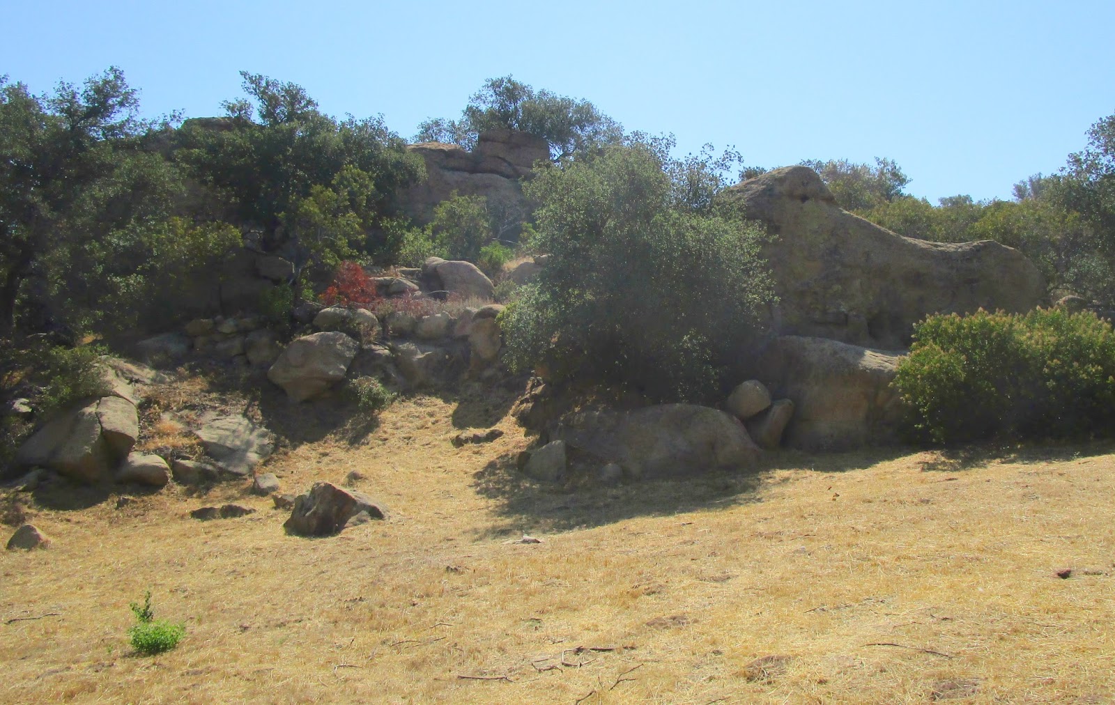
Just behind the Gate to Nowhere is a movie rock. For our purposes we can call it "Gate to Nowhere Rock."

"Daredevils of the West": Gate to Nowhere Rock

Remember the shot at the top of this post from the serial "Daredevils of the West"? That's Gate to Nowhere Rock at the right of the frame — with the runaway stage headed straight for the future site of the Gate to Nowhere.

"The Roy Rogers Show" (1951)

Here's a similar shot from an early episode of "The Roy Rogers Show," with Gate to Nowhere Rock again seen at the right. The episode is "Doc Stevens' Traveling Store" — and that's the store traveling along Cliff Road.

Google aerial showing a portion of the Lower Iverson

This recent aerial photo from Google shows most of the Lower Iverson, including the entire area that has been preserved as public parkland. I've pinpointed where the Gate to Nowhere and its nearby rock can be found.

Google map of the Lower Iverson: The area in green has been preserved as public land

Besides spanning a road that goes nowhere and is both unusable and inaccessible, the gate and its "Private Property" sign are totally in the wrong place. The gate is positioned well within park boundaries, on public land.

Monday, June 27, 2016

An old forgotten movie road is discovered on the Upper Iverson

Old movie road on the Upper Iverson — bottom left corner

Iverson explorer Cliff Roberts tipped me off recently that he spotted what appeared to be an old abandoned movie road during a visit to the former Upper Iverson Movie Ranch.

A row of stone buttressing, now largely hidden in dry grass, marks the base of the road, which works its way south up Cactus Hill — toward the right in this photo.

The road is mostly overgrown now, but much of the buttressing remains intact.

The road is located on the Upper Iverson's Southwest Rim and extends up Cactus Hill from the hill's north side.

The buttressing is impressive, continuing up the hill along the northwest edge of the road. The road has been documented previously, but has remained relatively obscure. This was my first time exploring it.

This recent Google aerial shows approximately where the stone buttressing is located. The buttressed section of road runs along the foot of a large rock feature widely known as Prominent Rock.

Comparing the recent aerial view with a shot of the same area from 1952, we can see that the movie road had a substantial footprint back in the filming era. (The next photo pinpoints the footprint.)

This version of the 1952 aerial delineates the route followed by the movie road. The southern end of the road connected with the main network of roads traversing the top of Cactus Hill.

The "footprint" seen in 1952 no longer exists. The main road has been widened to provide access to the water tanks, and other smaller roads also remain in place, but the buttressed movie road has been overtaken by foliage.

Back at ground level, Cliff walks ahead on the road, heading southwest

While we're not the first location enthusiasts to find our way to the road, it has been lying dormant in recent years and remains one of the Upper Iverson's well-kept secrets.

The buttressing area is sheltered by trees and remains green, even after years of drought. The terrain around the road is quite scenic in spots, but poison oak is rampant in the area.

Here's another shot of the buttressing, this time looking northeast toward the base of the road. The road was first noted by location researcher Tinsley E. Yarbrough in "Those Great Western Movie Locations," published in 2008.

The road rises as it works its way south; this shot from ground level includes an elevated section of buttressing in the left half of the frame. As it continues south, the road passes behind the bulbous rock feature on the right.

The buttressing is identified here, along with the bulbous rock, which some readers may recognize from the backgrounds of Western chase sequences. I call the rock "Bignose," for lack of a better word.

This unusual "character," which is part of the buttressing, reminds me of a toadstool. As the buttressing is manmade, I can't help wondering whether somebody realized what they were creating when they set this up.

Farther up the hill, the road becomes virtually impassable.

The rugged area near the top of the road is dominated by sagebrush and other vegetation, punctuated by dynamic sandstone formations.

I inadvertently spooked a mother bird in her nest as I tromped past, leaving me face to face with her frightened chicks after the mom flew the coop. The area doesn't get much foot traffic.

"Lawless Cowboys" (1951): Whip Wilson on the buttressed road

The most extensive filming on the old road appears to have taken place near the base of the road — the buttressed section — as in this example from the Monogram B-Western "Lawless Cowboys."

This shot taken on a recent expedition shows the same stretch of road.

I've identified a couple of rock features here that can also be seen in the Whip Wilson screen shot.

Here's the "Lawless Cowboys" shot again, with rocks "A" and "B" noted. 

This shot provides a closer look at rock "B." The sharp angle at the top of it makes it readily identifiable.

Notice the tree identified here, which is located next to rock B.

The tree is gone now, but its stump remains.

Here's a closeup of the stump, revealing that it has a wire tied around it. I don't know what that's about, but would be interested in hearing any theories.

"Lawless Cowboys": Whip Wilson rides northeast from the buttressed road

A wide shot from "Lawless Cowboys" shows the area on the Upper Iverson's Southwest Rim where the north end of the buttressed road empties out onto the flatland.

A number of features can be identified in the "Lawless Cowboys" shot. Some of these features will be familiar to veteran Iverson Movie Ranch watchers.

Notice the rock feature highlighted here. This small rock wall is positioned near the base of the buttressed road.

The small rock wall remains in place today, as seen in this photo from our recent visit.

I tried to get a shot capturing the juxtaposition of Round Rock and the small rock wall, similar to the "Lawless Cowboys" shot, but the tree near Round Rock has grown so big that it blocks the view of the rock from this angle.

"Leadville Gunslinger" (Allan "Rocky" Lane, 1952)

Tinsley Yarbrough notes in "Those Great Western Movie Locations" that Rocky Lane traveled the road in "Leadville Gunslinger." The above shot from the movie was filmed about halfway up the road.

"Shadow Rock," adjacent to the old movie road

One of the rocks situated right next to the movie road is Shadow Rock. While it may seem like a bit player in this shot, it's usually seen from other angles and is a significant movie rock in its own right.

Shadow Rock in its usual circumstances: shrouded in shadows

You may have already noticed that Shadow Rock is almost hidden in darkness. That's virtually always the case with Shadow Rock, which is why I started calling it that.

"Rawhide Rangers" (Universal, 1941)

A similar shot can be found in the Johnny Mack Brown movie "Rawhide Rangers." In this case the shadows haven't quite reached Shadow Rock yet, but even so, the front end of the rock isn't exactly lit up.

"The Tiger Woman" (1944)

A more typical appearance for Shadow Rock is this one in the Republic serial "The Tiger Woman."

As usual, the front end of the rock is in shadow.

"California Firebrand" (Republic, 1948)

There's Shadow Rock yet again, directly above the horses in the Monte Hale Western "California Firebrand." The rock appears in color this time, but there's that shadow again — some things never change.

"Rawhide Rangers": Shadow Rock and Shadow Rock Road

Since the old movie road goes right past Shadow Rock — and since it seems like a good name for an old movie road — I started calling it "Shadow Rock Road."

"Leadville Gunslinger": Shadow Rock Road and the view to the north

Besides filming the Shadow Rock end of the road, the "Leadville Gunslinger" crew turned the camera in the other direction. With the camera now facing north, we see a part of the road with a view of the Upper Iverson.

"Gold Raiders" (Three Stooges, 1951)

The buttressing near the bottom section of the road can be spotted occasionally in backgrounds, as in the Three Stooges movie "Gold Raiders."

The "Gold Raiders" shot illustrates the road's position between Prominent Rock and the small rock wall.

"Adventures of Spin and Marty" (1955): Stone buttressing on the Lower Iverson

Stone buttressing has survived in a number of locations on the former Iverson Ranch. The best-known example is found along the "Steep Canyon Road" that runs through the Gorge below Nyoka Cliff.

Promo still for "Pack Train" (1953) — photo from the Jerry England collection

A classic shot of this buttressing on the Lower Iverson appears in a promotional still for the Gene Autry movie "Pack Train." This is essentially the same section seen in the shot from "Spin and Marty."

Lower Nyoka Cliff and the Steep Canyon Road in 2014

The buttressing seen in "Spin and Marty" and "Pack Train" has deteriorated significantly since the filming era, but remains somewhat intact.

This shot points out the portion of the stone buttressing that appears in the movie and TV shots above.

A number of other sections of the buttressing along the Steep Canyon Road have also survived.

An especially well-preserved section of buttressing is found higher up in the Gorge, below Lone Ranger Rock.

The Steep Canyon Road is also known as the stagecoach road, although that name has led to the mistaken belief that it was an actual stagecoach road, an issue I talked about in an earlier post that you can click here to read.


Above is a link to a nine-movie DVD set that includes "Lawless Cowboys" and a number of other cool Iverson movies in terrific picture quality, in case you might be into that sort of thing — mostly Whip Wilson and Johnny Mack Brown B-Westerns, along with a couple of non-Iverson Jimmy Wakely movies.